
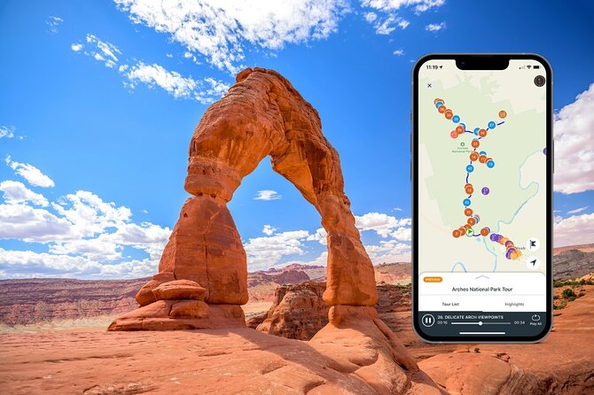
Reviewed · SELF-GUIDED AUDIO DRIVING TOURS
Utah Mighty 5 Adventure Bundle: 8 Self-Guided Audio Tours
Utah’s red-rock parks are easier when someone does the talking. This bundle uses a Shaka Guide app with GPS turn-by-turn directions and auto-play stories, so you can explore at your own speed. I especially liked the offline maps (no signal required) and the way the narration helps you decide fast what’s worth a stop. The one thing to watch is that major hikes with permits often require you to handle those permits yourself.
Because it’s self-guided, you’re not stuck in a rigid group rhythm. You can pause the story, park when something grabs you, and move on when you’re done. The price is also friendly for groups since it’s per group/vehicle (up to 15), and you keep access for good.
That said, this is a driving-and-walking mix, not a full bus tour. You’ll still need to plan for park entrance fees, water, and the fact that some stops involve real effort and thin air.
In This Review
- Key highlights in plain English
- Price and logistics: what you’re really paying for
- How the Shaka Guide app keeps you moving (and saves your sanity)
- Day 1 in Zion: Kolob Canyons, Grafton, and the Angel’s Landing permit reality
- Day 2 Bryce Canyon: scenic drive power plus hoodoo concentration
- Day 3 Capitol Reef: orchards, petroglyphs, and watch for flash-flood logic
- Day 4 Canyonlands (Island in the Sky): sunrise arches and serious walking choices
- Day 5 La Sal Mountains and Moab-area stops: lakes, dinosaur tracks, and canyon culture
- Day 6 Arches National Park: Delicate Arch, Devils Garden, and Fiery Furnace permits
- Day 7 Goblin Valley: pictographs, hoodoo towers, and slot-canyon surprises
- Day 8 Southern Utah add-ons: Kanab dinosaur tracks to Escalante waterfalls
- Who should book this Utah Mighty 5 bundle?
- Should you book this audio bundle?
- FAQ
- What parks are covered in this bundle?
- Do I need cell service to use the app?
- How long is the experience?
- Where does the tour start and end?
- Are national park entry fees included?
- Are permits included for Angel’s Landing or Fiery Furnace?
- Is the tour audio in English?
Key highlights in plain English
- Offline GPS and maps that work where cell service goes to die
- Auto-play audio with music while you drive, plus practical trail details when you park
- One tour covers the vehicle, so the cost scales well for families and small groups
- Permit-aware planning, since some of the iconic hikes are permit-only and not included
- A smart mix of big “wow” viewpoints and short walks, so you can match the day to your energy
More drives to run at your own pace
- Arches National Park Self-Guided Driving Audio Tour★ 4.5 · 288 reviews
- Arches and Canyonlands NP Self-Guided Driving Audio Bundle Tour★ 4.5 · 68 reviews
- Canyonlands National Park Self-Guided Driving Audio Tour★ 4.5 · 54 reviews
- Full-Day Audio Driving Tour of Arches National Park★ 4.5 · 27 reviews
Price and logistics: what you’re really paying for
At $31.19 per group (up to 15), this bundle is built for road trips with shared costs. That’s the main value: you’re not paying per person for audio, and you can use the same access across multiple days instead of squeezing every minute.
You will still pay park entry fees separately. That’s normal for Utah’s Mighty Five style trips, but it matters for your budget. Also, a few add-ons cost extra once you arrive, like the Capitol Reef Scenic Drive fee ($20 per car). In other words: the audio is the bargain; the parks still have their own rules and fees.
This is designed to start and end in Moab. The route threads through Zion, Bryce, Capitol Reef, Canyonlands, Arches, plus state-park-style add-ons around Goblin Valley and further south.
How the Shaka Guide app keeps you moving (and saves your sanity)
This is where the experience feels different from “read a brochure and hope.” The app gives turn-by-turn GPS directions, and it plays narration, travel tips, and music automatically as you drive. When you reach a stop, the audio switches to what to look for on foot.
Big practical win: offline access. You download ahead of time using strong Wi‑Fi, then you can run the maps and GPS without relying on service in remote areas. That matters around places like canyon country where you can lose signal at exactly the wrong time.
One small tech tip I’d treat like gospel: keep your phone plugged in. GPS can eat battery fast. And if you stop walking and you’re done for the day, turn off the tour so it doesn’t keep working in the background.
The app also supports flexibility. You can start, pause, and resume on your schedule, and you can skip stops you don’t want. That’s huge when you’re trying to balance a short hike, a long lunch, and a sunset you don’t want to miss.
Day 1 in Zion: Kolob Canyons, Grafton, and the Angel’s Landing permit reality
Day one is Zion-heavy, with a great flow from Kolob Canyons over to Zion Canyon and then into East Zion options. I like that the day doesn’t just throw you into the busiest viewpoints. It gives you earlier scenes first, including Kolob’s big silence and easy overlooks.
You start at Kolob Canyons, and the audio cues you to check in at the Kolob Canyons Visitor Center to show your park pass. Then it guides you to Timber Creek Overlook Trail, a short, easy walk with panoramic views over the Pine Valley Mountains and more. Next up is La Verkin Overlook, a quick stop with a wide view stretching across Zion Canyon and the Virgin River Gorge.
The app then nudges you toward one of Zion’s headline canyoneering locations: The Subway. Here’s the key planning detail: it requires a wilderness permit from the Zion lottery, and you’ll need a ticket/permit to do it. Audio can’t fix that part for you, so plan ahead if this is on your must-do list.
After that come Lava Point Overlook (a basalt cliff above a green, forested volcanic valley) and then Grafton. Grafton is a fun detour: the audio points you toward the Grafton Cemetery and then the ghost town area. You can wander around abandoned cabins and buildings, and it’s also tied to a famous movie moment, so it’s a natural “quick photos and stories” stop.
Once you reach Zion Canyon Visitor Center, you get the practical baseline: rangers, maps, restrooms, and the place to pick up wilderness permits if your plans need them. If shuttle traffic looks intimidating, the app gives you an alternate route: the Pa’rus Trail to the Human History Museum. It’s 1.7 miles one way, and it’s one of the rare Zion trails where bikes or dogs are allowed, so it’s a good tool if your group moves at different speeds.
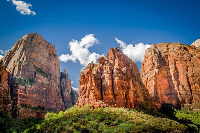
At Human History Museum, you’re pointed toward the patio view and the chance to catch a ranger talk. Then it hits Court of the Patriarchs for a quick, clever formation view—Abraham, Isaac, and Jacob from left to right.
The day builds toward the classic walking: Emerald Pools (Lower Emerald Pools). This one’s a family-friendly 2-mile trail with drips from sandstone and hanging-garden style greenery. If you want a “big Zion payoff” without a technical mindset, this is it.
Then comes the part you should treat as serious: Angel’s Landing. The audio describes the chain-assisted ascent and the payoff view, plus the reality that Angel’s Landing now requires a permit. That permit is not included in park entry or the tour. If you don’t want to (or can’t) do Angel’s Landing, the app suggests Scout’s Lookout as an equally stunning alternative and helps you gauge time loss from crowding.
Later, you’ll hear the story behind Weeping Rock and you’re guided to a short paved walk (half mile round trip). The audio ends the canyon stretch at Temple of Sinawava, where you’d disembark for The Narrows. Narrows planning typically hinges on permits, season, and water conditions, so use the app for orientation but still check official guidance before you commit.
On your way out, the day includes viewpoint and photo stops like The Great Arch (a blind arch you can spot from the road), Canyon Overlook Trail (a 1-mile elevated feel without an extreme climb), Checkerboard Mesa (that criss-cross pattern you’ll see best from a left-side pull-off), and then East Entrance Ranger Station where you can branch to heavier hitters like Observation Point and the East Mesa Trail network.
Day 1 takeaway: this is the Zion day for people who want both short walks and major icons—just be permit-ready.
Day 2 Bryce Canyon: scenic drive power plus hoodoo concentration
Bryce Canyon is the kind of place where the driving portion can feel like sightseeing on rails. Day two starts in Bryce Canyon City and stops at Ruby’s Inn. The point of that first block is simple: fuel up, grab snacks, and decide how much of the park you’ll tackle today.
Then you enter Bryce Canyon National Park and the app encourages you to use the Bryce Canyon Scenic Drive plus stops in both Bryce Amphitheater and the scenic drive pull-offs. This is a smart way to do Bryce because the hoodoos hit you repeatedly, and you’re not stuck committing to one long hike early.
A must-use stop: the Bryce Canyon Visitor Center, where you can watch the award-winning 20-minute film Shadows Through Time and check in with park ranger staff for daily talks and tours. The audio also points you to key viewpoints such as Fairyland Point, Rainbow Point (highest point in the park at 9,100 feet), and Yovimpa Point for more layers in the Grand Staircase view.
The app sprinkles in short walks too. Bristlecone Loop (one mile) takes you through ancient bristlecone pine terrain, and Black Birch Canyon and Ponderosa Canyon provide quick, contrasty looks at forested edges with Navajo Mountain in the distance.
For photos, this day has a steady drumbeat of stops for hoodoo shapes and viewpoints like Agua Canyon (including Backpacker and the Rabbit) and Thor’s Hammer sightings. It also pushes you toward Piracy Point, with a gentle path experience and a distant “ship” look for the formation.
You end with one of the best relaxed finishers: Swamp Canyon. This viewpoint has a natural water source, so the vegetation runs greener and you can even spot birds overhead. If you’re feeling energetic, there’s a longer Swamp Canyon Loop option, but the audio keeps it flexible for everyone.
Then it shifts back to the main amphitheater area: Bryce Amphitheater viewpoints like Sunrise, Sunset, Bryce, Inspiration, and Paria View. From there you can choose your level of effort with stops such as Bryce Point (including the advanced Peek-a-Boo Loop trailhead) and Inspiration Point, where the hoodoos look like a frozen city.
You’ll also hit Paria View (known for Peregrine falcons) and Sunset Point for iconic angles and the trailhead for Navajo Loop Trail. The day ends at Mossy Cave Trail, which is technically outside park gates and gives you a cool, gentle walk with a waterfall end-point.
Day 2 takeaway: use the scenic drive to get the canyon’s rhythm fast, then pick one walk so you don’t burn the day.
More Moab days made easy with a guide


Day 3 Capitol Reef: orchards, petroglyphs, and watch for flash-flood logic
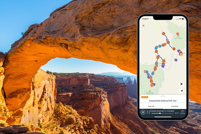
Day three is Capitol Reef with a “slow down and smell the fruit” vibe. Start in Torrey, where it tells you this is the last major gas and where you can stock up on food and water before the longer stretches.
The hiking energy begins with Chimney Rock Loop Trail, a strenuous climb with big views from the Mummy Cliffs area. If you want to save your legs for later light, the audio even suggests doing it later since sunset views can be extra good.
Then you go to easier overlooks like Panorama Point and Goosenecks Overlook. The Goosenecks stop includes a short 600-foot walk with the “how did the creek cut that?” feeling, plus a nearby Sunset Point viewpoint.
Once you reach the Capitol Reef National Park Visitor Center, you get a practical anchor point: exhibits, a film, and a chance to speak with a ranger for geology or night-sky programming.
A standout for non-hikers: Ripple Rock Nature Center and the Fruita orchards. The audio notes that Mormon settlers planted the orchards more than 100 years ago and that fruit can still be picked in-season. Rules exist here, so follow them and plan for sticky hands and better photos afterward.
Then it moves to Gifford House & Museum Store, plus pies made with orchard fruit. This is where Capitol Reef feels less like just geology and more like a living place with a working culture.
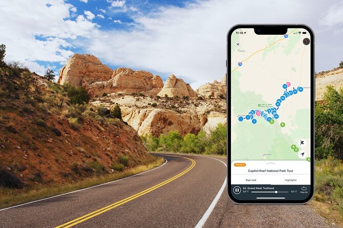
The day includes the famous Capitol Reef Scenic Drive (7.9 miles) with great sights and two unpaved spur roads. Important warning from the audio: flash floods are a real danger if storms roll in, and canyon entrances can be closed by weather. The scenic drive has a $20 per car entry cost.
Next comes Grand Wash Road, where you can hike Grand Wash (easy flat ground) or consider Cassidy Arch (strenuous climb). There’s also mention of abandoned uranium mines and Echo Cliff for echoing.
Then the tour reaches Capitol Gorge Trail, where the pacing shifts to history details: petroglyphs from Fremont culture, a Pioneer Register of names carved into rock, and water-catching sandstone “Tanks” that create micro-ecosystems. There are also viewpoints like Golden Throne.
Don’t skip Fruita Schoolhouse and the nearby Fremont Petroglyphs—the audio points out the wooden walkways that keep the viewing respectful and easy.
Later, you get the geology theory in viewpoint form at Capitol Dome View Area, plus options like Rim Overlook, Navajo Knobs, and Hickman Bridge for arch views. Then Behunin Cabin adds human scale: a small sandstone structure that once housed a family of 15, including kids sleeping outside in makeshift areas.
The day closes with broad views at Waterpocket Fold and then optional time at Notom (a ghost-town stop with a marker and a grave). If you’re hungry, Mesa Farm Market is suggested for local organic bites. Then there are viewpoints like Factory Butte, with a warning that some roads like Moonscape Overlook call for high-clearance vehicles.
Finally, it ends near Hanksville and the Wolverton Mill, a historic mill tied to gold ore processing, giving you the last “why this place matters” chapter.
Day 3 takeaway: mix one hard hike with several short stops, and keep weather awareness high.
Day 4 Canyonlands (Island in the Sky): sunrise arches and serious walking choices
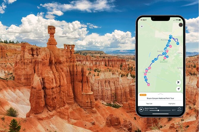
Day four is Canyonlands in the Island in the Sky district, with an 8-hour timebox that makes sense because the stops stack up well. You start at Canyonlands National Park with scenic highlights like Dead Horse Point, Green River Overlook, Mesa Arch, and options for hiking trails including Upheaval Dome.
The audio pulls you to Monitor and Merrimac Rock Formations, named for ironclad warships based on their shape. Then it gives you Navajo Rocks Main Parking Lot, a biking-friendly area with singletrack terrain.
One of the easiest “two-for-one” moments is Dead Horse Point State Park, which sits right off the main drive and gives a distinct view even though it’s on the same mesa. Then you stop at Island in the Sky Visitor Center, the only district area with potable water and flushing toilets, so this is where you refill and plan.
Later you get Shafer Canyon Overlook, with a look down at the Shafer Trail’s switchbacks. The audio notes that if you have the right vehicle, you can consider taking the Shafer Trail back to Moab after the tour.
Then you hit Mesa Arch, a half-mile round trip over dirt and slickrock. The narration points out why everyone loves it: sunrise views, and the parking lot fills early. If you’re going later, you’ll still get an arch photo, but it won’t feel the same.
Other iconic stops follow: Candlestick Tower Overlook, with a 450-foot tower that’s popular for rock climbing; Buck Canyon Overlook for layered canyon views; and White Rim Overlook Trail for a relatively flat 1.8-mile round trip with a 360-degree feel.
You also get scenic “big picture” stops: Orange Cliffs Overlook, Grand View Point Overlook, and Green River Overlook. The audio connects the views to the river carving the area over time, which makes the geography feel less random.
Then it turns to history hikes: Aztec Butte Trail leads to ancestral Puebloan stone granary structures built around 1200 AD. After that, Whale Rock offers a one-mile round-trip hike with easy-to-moderate difficulty.
The biggest “choose your own adventure” moment is Upheaval Dome. The audio explains it with a big uncertainty theme and offers two exploration styles: a one-mile round trip to overlooks (recommended) or an eight-mile trail loop that’s more intense and where rescues happen more often.
If you want a challenge, the tour also references a rough 12-mile round trip hike with steep descent to rock towers named Moses and Zeus.
Day 4 takeaway: treat early starts as optional, but treat the hikes as planned effort.
Day 5 La Sal Mountains and Moab-area stops: lakes, dinosaur tracks, and canyon culture

Day five is the La Sal and Moab-area storytelling day. It starts at Ken’s Lake, a campsite scene with a small waterfall hike nearby. The audio frames it as a quick reset: park, breathe, take a short walk.
Then it moves to Brumley Arch, only two miles round trip but steep, plus the note that you may need an optional gravel road drive to reach the trail. Oowah Lake and Warner Lake are next, both described as rainbow trout fishing spots with high elevation and scenic mountain reflections.
If you like walking while you snack, the app calls out a 1.6-mile round-trip option connecting the two lakes. Then you get a broad view at Castle Valley, with the Colorado Plateau stretching below and views toward Porcupine Rim, Castle Valley, Arches National Park, and Canyonlands.
Next is a detour worth time: Bull Canyon Overlook and Dinosaur Track Site. No big hike here, but it takes 30–40 minutes to soak up the Jurassic-era track story.
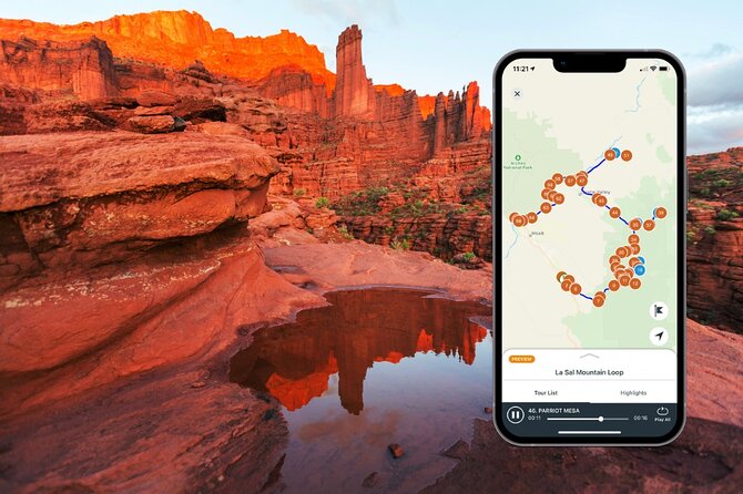
Then you climb the “tower and mesa” theme: Castleton Tower, Parriott Mesa (noted as a magnet for climbers, with a challenging three-mile round-trip hike if you’re prepared), and Fisher Towers, including movie backdrop references.
In Moab you get a cultural palate cleanser: Moab Giants museum at Red Cliffs Lodge. The audio calls it free, with pioneer artifacts and film memorabilia.
After that, the route moves toward water recreation history with Salt Wash and the Takeout Beach area where many river trips end. Finally, Courthouse Wash adds Fremont pictograph context and includes a short hike of about 500 feet from the parking area.
Day 5 takeaway: this is your “nature plus human stories” day that doesn’t require mega hikes every stop.
Day 6 Arches National Park: Delicate Arch, Devils Garden, and Fiery Furnace permits
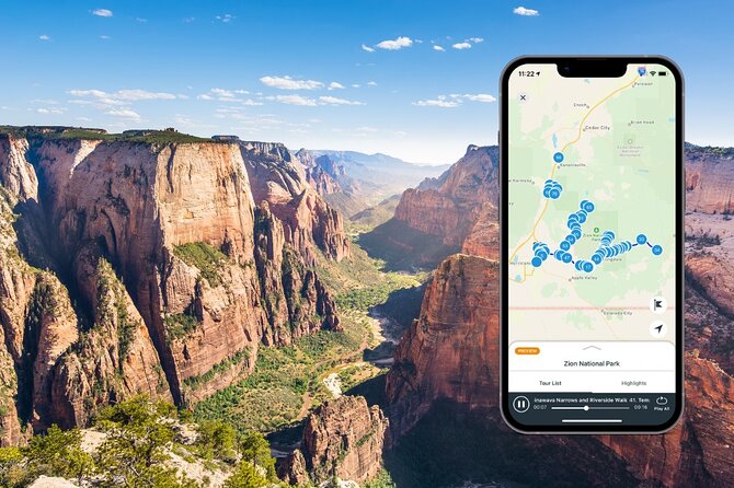
Day six is Arches with a full-day pacing (the audio lists up to 8 hours). The app explains why Arches matters: high concentration of natural stone arches. It cues you for famous stops like Delicate Arch, Landscape Arch, Double O Arch, and others.
You start at Arches main driving entry, then it tells you to stop at the Visitor Center. This is where you can get water, restrooms, and snacks, and the audio notes that options are limited elsewhere in the park.
Then the scenic “texture” stops begin: Moab Fault Overlook for geology pressure stories, Park Avenue Trail (with a skyscraper-in-a-city comparison), and La Sal Mountains Viewpoint with the name origin and the high peaks.
From there it zooms back into arches and towers: Courthouse Towers, Petrified Dunes Viewpoint (sand dunes turned rock), and Balanced Rock Trail for the classic “giant hoodoo with a ball” photo moment.
Then comes The Windows Road, including The Windows, Turret Arch, and Double Arch, tied in the audio to movie scenes. Next is Garden of Eden, where it warns there’s no designated trail and you should watch your step because of biocrust (small living surfaces).
Pothole Arch follows, described as horizontal rather than the vertical style of many arches.
The day also includes multiple Delicate Arch solutions. Delicate Arch itself is a hike plan, and the audio points out that if you don’t have time or a reservation for the hike, you can still see it from lower and upper viewpoints with short walks from the parking area.
For other geology arcs, you’ll get Salt Valley Overlook and then Fiery Furnace. Here’s another permit reality check: Fiery Furnace has a permit-only hike and permits are limited and must be reserved online. The audio says it isn’t recommended for this tour due to difficulty.
You finish with lighter arch stops: Sand Dune Arch Trail (a short visit for kids and adults), Skyline Arch (mostly “walk up close if you want”), and Devils Garden, a short hike with picnic tables and restrooms. The star there is Landscape Arch, described as the longest arch in North America.
Day 6 takeaway: Arches is famous for short hikes and big payoff, but plan your Delicate Arch choice before you get stuck deciding in the heat.
Day 7 Goblin Valley: pictographs, hoodoo towers, and slot-canyon surprises
Day seven shifts to state-park-style scenery around Goblin Valley State Park. It starts with Temple Mountain Wash Pictograph Panel, reachable by an easy trail and described as showing dogs, other animals, humans, and symbols.
Then you move to Wild Horse Window Trailhead, a 1.8-mile out-and-back that the audio frames as moderately challenging. After that, you reach the Goblin Valley Visitor Center with newly renovated restrooms featuring flushing toilets, plus ranger programs you can ask about.
The big “time sink” stop is Goblin Overlook with a long 3-hour window. Then you get the iconic Three Sisters rock formation, and the route finishes with canyon trails: Entrada Canyon Trailhead (1.8-mile out-and-back, generally easy) and Little Wild Horse Canyon, a family-friendly slot canyon hike with narrows where you may need to turn sideways to fit through.
Day 7 takeaway: this is a good day for families who want short-to-medium hikes, plus one serious viewpoint session.
Day 8 Southern Utah add-ons: Kanab dinosaur tracks to Escalante waterfalls
Day eight is packed with extra stops outside the big national parks, which is exactly why this bundle feels like more than just five checkboxes. It starts at Dinosaur Tracks Trailhead in the Utah Port of Entry area north of Kanab. The audio describes a 1.5-mile round-trip moderate hike with about 200 feet of incline.
Then you go to Sand Caves, described as man-made caves formed by miners excavating sand in the early 20th century. The trail is short and easy (about a mile) on mostly soft sand, and you can explore interconnected tunnels and chambers.
The route also includes a museum focused on Moqui Indians, with artifacts and exhibits about their way of life, plus natural history and geology.
From there it heads into slot-canyon territory: Peek-A-Boo Slot Canyon (about 0.7 miles round-trip, short and easy) and Elkheart Cliffs (a dry slot canyon called Diana’s Throne Canyon in the audio notes).
Another fun detour is the man-made tunnel trail. It starts from an easy 1.8-mile out-and-back, but the main feature is a drainage culvert under Highway 89 where water erosion shaped the sandstone tunnel. You’ll need to scramble down a short distance to get to the tunnel.
Later, the audio points you to an arts-centered town founded by Jack and Fern Morrison, with the Maynard Dixon art gallery and the historic Rock Church. Then there’s a Rock Stop shop noted for handmade crafts, Native American artifacts, Zion souvenirs, and snacks.
You also get more scenery options: Red Canyon State Park (with hikes like Canyon Overlook Trail, Castleton Trail, and Peekaboo Loop Trail), plus Bryce Canyon City as a gateway. The tour includes Mossy Cave Trail again here as a short walk to a cool, moist cave.
Further south, it covers Kodachrome Basin State Park and Escalante Petrified Forest State Park, including hiking trails described in the audio like Whispering Sands and Petrified Forest trails. It also includes the Escalante Interagency Visitor Center, which is a good place for maps, permits, and recommendations.
The audio then threads the Scenic Byway 12 corridor: Hell’s Backbone Scenic Byway (steep grades and winding curves), Escalante Heritage Center, Hole in the Rock Wayside, and multiple lookouts like Head of the Rocks, Boynton Overlook, plus Kiva Koffeehouse.
Finally, it gets waterfall-heavy near Calf Creek: Calf Creek Falls (a 126-foot waterfall after a 6-mile round trip) and Upper Calf Creek Falls Trail (a shorter but steep 2-mile hike to an 88-foot waterfall). The audio also references Hogback formation for panoramic views and includes a stop around Boulder with the Anasazi State Park Museum.
Day 8 takeaway: treat this as your “choose your favorites” day, because you can’t do all of it in one go unless you move fast and commit to hikes.
Who should book this Utah Mighty 5 bundle?
Book this if you want freedom: you’re okay driving between stops and you like deciding when to park and hike versus stay in the car for views. It’s also a strong fit for groups since the price is per vehicle/group and the app runs through a private setup for your group.
You’ll especially enjoy it if you care about practical planning. The narration helps you understand what you’re seeing and what to expect once you step out of the car. It’s great when you don’t want to guess trail effort in a hurry.
Skip this (or at least plan around it) if you rely on permits being included. Angel’s Landing and Fiery Furnace are permit-only for hiking, and The Subway requires a wilderness permit from the Zion lottery. You’ll need to handle those separately.
Should you book this audio bundle?
I’d book it if your goal is to see Utah’s icons over multiple days without feeling chained to a tour bus. The offline GPS, the auto-play narration, and the “stop when you want” pacing make it a real road-trip tool, not just audio for the car.
If you do book, my advice is simple: pick one hard hike per day (or swap it with a shorter one), download the maps ahead of time, keep your phone charged, and treat permits as an early task, not a last-minute surprise.
FAQ
What parks are covered in this bundle?
The included audio tours cover Arches, Canyonlands, La Sal, Zion, Bryce, and Capitol Reef.
Do I need cell service to use the app?
No. The app includes offline map access, and map/GPS work completely offline after you download using Wi‑Fi.
How long is the experience?
It runs over about 8 days, with some park sections listed as full-day drives and others as shorter stop sequences.
Where does the tour start and end?
It starts and ends in Moab, UT 84532, USA.
Are national park entry fees included?
No. Entry fees are not included, and you’ll still need to pay for park access yourself.
Are permits included for Angel’s Landing or Fiery Furnace?
No. Angel’s Landing requires a permit that is not included, and Fiery Furnace is also permit-only and requires online reservations.
Is the tour audio in English?
Yes, the mobile ticket and audio are offered in English.
More Tours in Moab
- Canyonlands National Park Half-Day Tour from Moab
★ 5.0 · 1,074 reviews - The Best U-Drive Hell’s Revenge 4×4 Off Roading Tour from Moab
★ 5.0 · 909 reviews - Thrilling 3.5 Hour You-Drive Fins N Things/Hells Revenge UTV Tour
★ 5.0 · 816 reviews - BEST! Hell’s Revenge U-Drive 4X4 Tour in Moab +Dinosaur Tracks!
★ 5.0 · 729 reviews - HIGHLY RATED Arches National Park Sightseeing Tour From Moab Utah
★ 5.0 · 474 reviews
More Tour Reviews in Moab
- HIGHLY RATED U-DRIVE Moab Hell’s Revenge UTV Off-Road Adventure
★ 5.0 · 3,107 reviews - Arches National Park 4×4 Adventure from Moab
★ 5.0 · 2,014 reviews - Moab: Colorado River Dinner Cruise with Music and Light Show
★ 4.5 · 1,302 reviews - You-Drive 4×4 UTV Adventure–Hell’s Revenge & Fins N’ Things, Moab
★ 5.0 · 1,114 reviews - Canyonlands National Park Half-Day Tour from Moab
★ 5.0 · 1,074 reviews
Drive It Yourself
- Arches National Park Self-Guided Driving Audio Tour
★ 4.5 · 288 reviews - Arches and Canyonlands NP Self-Guided Driving Audio Bundle Tour
★ 4.5 · 68 reviews - Canyonlands National Park Self-Guided Driving Audio Tour
★ 4.5 · 54 reviews - Full-Day Audio Driving Tour of Arches National Park
★ 4.5 · 27 reviews - Utah Mighty 5 National Parks Self-Guided Driving Audio Tours
★ 4.5 · 25 reviews
Fresh Off the Trail: Newest Moab Reviews
- Discover Moab Rappelling on a Private Canyoneering Adventure
★ 5.0 · 3 reviews - Moab Custom 4 Seat Kawasaki KRX® 1000 Off Road UTV Rental
★ 5.0 · 3 reviews - Moab: Half-Day Rock Climbing Adventure
★ 5.0 · 3 reviews - Moab Half Day Kayaking Trip – Colorado River
★ 4.6 · 3 reviews - From Moab: Rock of Ages Moderate Rappelling Obstacle Course
★ 5.0 · 3 reviews - Professional Stargazing in Moab
★ 3.5 · 3 reviews
Self-Guided Audio Driving Tours, compared.
 ★ 4.5Arches National Park Self-Guided Driving Audio TourFrom $16288 reviews
 ★ 4.5Arches and Canyonlands NP Self-Guided Driving Audio Bundle TourFrom $2468 reviews
 ★ 4.5Canyonlands National Park Self-Guided Driving Audio TourFrom $1654 reviews
 ★ 4.5Full-Day Audio Driving Tour of Arches National ParkFrom $1227 reviews
 ★ 4.5Utah Mighty 5 National Parks Self-Guided Driving Audio ToursFrom $3225 reviews
 ★ 4.5Self Guided Audio Tour in Arches and CanyonlandsFrom $2416 reviews
 ★ 4.5Moab Bundle: Arches Canyonlands, and La Sal Self-Guided ToursFrom $1910 reviews
 ★ 3.5Self Guided Audio Driving Tour in Arches National ParkFrom $196 reviews
Browse the lists this tour appears in