
Reviewed · SELF-GUIDED AUDIO DRIVING TOURS
La Sal Mountain Loop Self-Guided Audio Tour
One road, a dozen-plus big views, and your own schedule. This La Sal Mountain Loop Self-Guided Audio Tour turns a scenic drive in Moab into a road trip with guided storytelling and hands-free directions.
What I like most is the offline GPS audio setup—no data or Wi‑Fi needed once you download, so you can focus on driving and stops. Second, the value is hard to beat: it’s $15.99 per group (up to 15), with lifetime access to the app and data.
The main drawback to consider is that this is still a driving route—if the La Sal Mountain Loop Road is closed (it happens), you may not be able to complete the full loop.
In This Review
- Key Highlights You’ll Notice Fast
- Why This Audio Tour Works So Well in Moab
- Price and What You Actually Get for $15.99
- Getting Started Without Stress (Before You Drive)
- The Real-World Timing: 4 to 6 Hours at a Calm Pace
- Driving the La Sal Mountain Loop: 13 Stops at Your Pace
- Stop 1: Ken’s Lake and a Short Waterfall Walk
- Stop 2: Brumley Arch (Steep, Short, and Worth It)
- Stop 3: Oowah Lake, High-Alpine Views, and Trout Fishing
- Stop 4: Warner Lake and the 1.6-Mile Link Between Lakes
- Stop 5: Castle Valley Panoramas Over the Colorado Plateau
- Stop 6: Bull Canyon Overlook and Dinosaur Tracks
- Stop 7: Castleton Tower and the Sandstone Tower Group
- Stop 8: Parriott Mesa and the Serious 3-Mile Option
- Stop 9: Fisher Towers, Movie-Set Rock Shapes, and a Trail
- Stop 10: Moab Giants Museum at Red Cliffs Lodge
- Stop 11: Salt Wash Meets the Colorado River
- Stop 12: Takeout Beach for River Trips
- Stop 13: Courthouse Wash Pictographs (A Short Walk)
- Where This Tour Shines Most (And Why)
- A Couple Things That Can Go Wrong (So You Can Avoid Them)
- Who This Tour Fits Best
- Should You Book This La Sal Mountain Loop Audio Tour?
- FAQ
- How long does the La Sal Mountain Loop self-guided audio tour take?
- Does it work offline with no data or Wi‑Fi?
- What language is the audio narration available in?
- Is there an entrance fee included for stops?
- Is this tour private for just my group?
- Can I bring a service animal?
Key Highlights You’ll Notice Fast
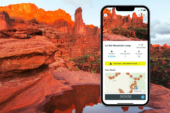
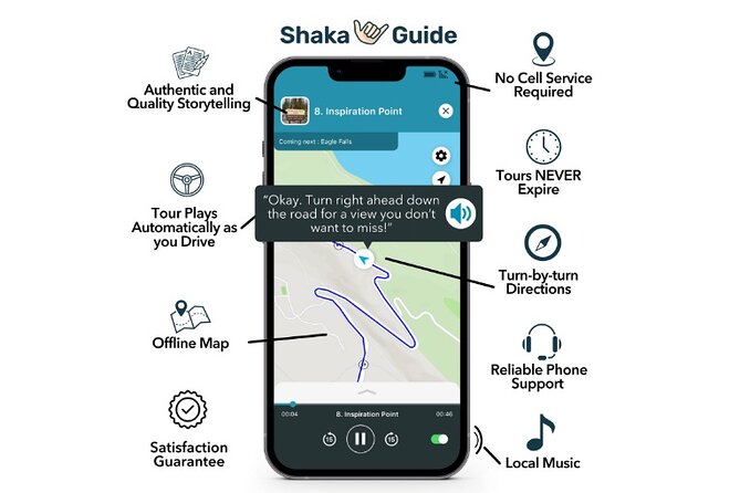
- Offline map + GPS turn-by-turn so you can drive without cell service
- Auto-playing narration as you drive, which makes the experience feel truly hands-free
- Free admission at most stops, including major viewpoints and short hikes
- 13 themed stops that mix lakes, sandstone formations, dinosaur tracks, and movie-set lore
- Private group experience with one tour per vehicle, not per person pricing
More drives to run at your own pace
- Arches National Park Self-Guided Driving Audio Tour★ 4.5 · 288 reviews
- Arches and Canyonlands NP Self-Guided Driving Audio Bundle Tour★ 4.5 · 68 reviews
- Canyonlands National Park Self-Guided Driving Audio Tour★ 4.5 · 54 reviews
- Full-Day Audio Driving Tour of Arches National Park★ 4.5 · 27 reviews
Why This Audio Tour Works So Well in Moab
Moab is the kind of place where you can either race from highlight to highlight or slow down and take it in. This tour nudges you toward the second option. You’re not locked into a group pace, and you can stop when something catches your eye—or skip a stop that doesn’t fit your mood.
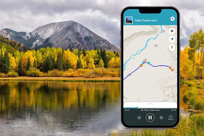
The practical win is that the tour is GPS-activated. As you drive, the narration and directions come in at the right moments, which keeps you from constantly checking your phone. It also helps you connect the dots: why a viewpoint matters, what you’re looking at on the ground, and what to do next.
And because it works offline, you’re not stuck hunting for service just to keep the audio going. For a mountain loop route, that matters.
Price and What You Actually Get for $15.99
This tour costs $15.99 per group, up to 15 people, for one vehicle. That’s a bargain if you’re traveling with friends or family, because you’re not paying “per head.”
You’re also paying for more than narration. You’re getting:
- the GPS audio driving tour
- narration that includes stories, travel tips, and music
- turn-by-turn directions
- offline map support
- lifetime access (it never expires)
One more value detail: many of the stops you’ll hit during the loop are listed as admission free, and the tour notes that entrance fees aren’t included. In practice, that often means you can enjoy most stops without paying anything extra—though it’s still smart to keep an eye out for any local signage.
Getting Started Without Stress (Before You Drive)
You’ll start and end at the same place on North Highway 191N, Hwy 191, Moab, UT 84532. From there, you’ll follow the GPS route and pick your own timing.
The biggest pre-trip tip is boring but important: download using strong Wi‑Fi before you leave. The tour is designed to run offline, but it still needs that first download step.
Also, plan for phone comfort:
- keep volume up enough to hear narration over tires and wind
- if your device tends to go quiet or lock during driving, adjust settings so the audio stays reliable
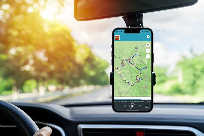
- if you know you’ll stop often, use a mount and keep the screen placement safe and easy to glance at
The Real-World Timing: 4 to 6 Hours at a Calm Pace
The tour is listed at about 4 to 6 hours. That’s a decent window for a self-drive loop, especially because many stops are designed around short parking-to-view breaks.
Most stops are about 20 minutes, but one of them needs more time. That flexible timing is where the tour shines: you can do the full drive without rushing, and you can expand a stop if you want a longer look.
More Moab days made easy with a guide


Driving the La Sal Mountain Loop: 13 Stops at Your Pace
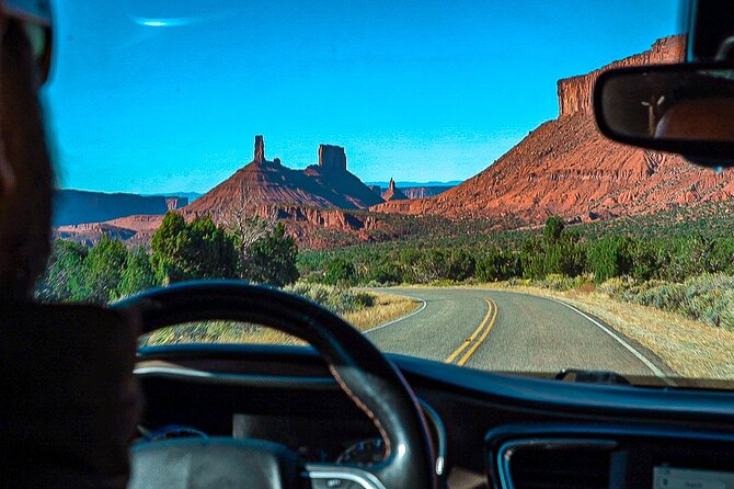
Stop 1: Ken’s Lake and a Short Waterfall Walk
Ken’s Lake is a campsite with a lake backdrop framed by the La Sal Mountains. If you want a quick leg-stretch, there’s a short hike from the lake to a small waterfall.
Why it’s worth your time: it’s one of those stops where the view is already good from the water, but you can add a little movement if you feel like it. Keep this as your early “wow” stop so the day starts strong.
Stop 2: Brumley Arch (Steep, Short, and Worth It)
Brumley Arch is only two miles round trip, but it’s described as pretty steep and strenuous. You also may need to drive on an optional gravel road to reach the trailhead.
What you should plan for:
- bring sturdy shoes if you’re going anywhere near steep slick sections
- expect the climb to feel bigger than the distance sounds
Reward-wise, the stop is designed around a payoff: a waterfall plus the Brumley Arch rock formation. If your legs are feeling good, this is one of the more active stops on the loop.
Stop 3: Oowah Lake, High-Alpine Views, and Trout Fishing
Oowah Lake sits at 8,800 feet (about 2,600 meters). It’s popular for rainbow trout fishing, and the lake often reflects the La Sal Mountains.
Even if you’re not fishing, the altitude and reflection angle make this stop feel like a different world from Moab’s lower elevation terrain. Plan to park, breathe, and enjoy the quiet.
Stop 4: Warner Lake and the 1.6-Mile Link Between Lakes
Warner Lake is slightly smaller than Oowah and also noted for rainbow trout fishing. Both areas can be serene on most days, but you might see a small crowd during holidays or summer weekends.
The big walking option here: a 1.6-mile round-trip hike connecting the two lakes. If you want to turn a short stop into a real mini-outing, this is the move.
Stop 5: Castle Valley Panoramas Over the Colorado Plateau
Castle Valley is one of the “step out, look, and let your camera rest” stops. You’ll get sweeping panoramic views down onto the Colorado Plateau below La Sal, with sightlines that include Porcupine Rim, Castle Valley, Arches National Park, and Canyonlands National Park.
This is a stop where it helps to slow down. Even if you’re not the hiking type, you’ll get a lot by just taking a few minutes to scan the layers of rock and distance.
Stop 6: Bull Canyon Overlook and Dinosaur Tracks
Bull Canyon Overlook and the Dinosaur Track Site is famous for dinosaur tracks left in the ground about 200 million years ago in the Jurassic period. The good part: no hiking is needed.
The time note matters, though. The detour can take about 30 to 40 minutes, so don’t stack this stop too tightly with other time-sensitive plans. This is a “pay attention to the ground” stop, not a “stride and snap photos while walking” stop.
Stop 7: Castleton Tower and the Sandstone Tower Group
Castleton Tower features a set of sandstone towers with names like Castleton Tower, the Rectory, and Sister Superior, rising as high as about 1,400 feet.
If you like geology and “how did that happen?” structures, this is a highlight. It’s also the kind of scene where the narration can make your brain click—naming the formations helps you see patterns instead of just shapes.
Stop 8: Parriott Mesa and the Serious 3-Mile Option
Parriott Mesa rises over 6,000 feet (about 1,800 meters) and looms over Castle Valley. The summit is described as more than 1.5 miles long and about a third of a mile wide, and it’s popular with climbers.
There’s also a three-mile round-trip hike to the summit, but it’s labeled pretty challenging, and you need to be very well-prepared.
How to play this if you’re not sure: use the stop for viewpoints and context. Only commit to the longer hike if conditions and your fitness match the challenge level described.
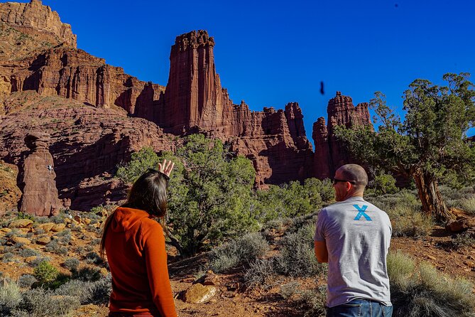
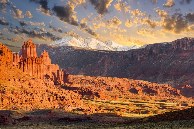
Stop 9: Fisher Towers, Movie-Set Rock Shapes, and a Trail
Fisher Towers is known for a hiking trail through sandstone features like towers, spires, hoodoos, ravines, and terraces. But it’s also called out for pop culture: it’s been used in backdrops for movies such as Austin Powers 3 and 6 Underground.
If you like a “see it in person” payoff, this stop tends to deliver. Even if you do only a portion of the trail, you’ll get the sense of scale that photos don’t show.
Stop 10: Moab Giants Museum at Red Cliffs Lodge
Moab Giants is part of the Red Cliffs Lodge, and the tour frames it as a fun detour for film lovers and local history nerds. It includes memorabilia connected to early films and more, with specific titles mentioned such as Wagon Master, Rio Grande, Taza Son of Cochise, City Slickers, Thelma & Louise, and more than a hundred television commercials shot in the area.
You won’t pay an admission fee to go in, which makes this a smart weather-proof break. If you want a calm indoor moment without giving up on the story of the region, this fits.
Stop 11: Salt Wash Meets the Colorado River
Salt Wash is where the Salt Wash River joins the Colorado River. If you have a kayak, the tour notes you can follow Salt Wash upstream and eventually pop out near Delicate Arch inside Arches National Park.
Even without water plans, the stop is useful. It helps you understand why this area is such a magnet for outdoor trips, not just sightseeing.
Stop 12: Takeout Beach for River Trips
Takeout Beach is where many kayaking and rafting trips end along the 13-mile Moab daily section of the Colorado River.
This is a great “put the whole trip together” moment. You’ll look at a familiar-sounding place name and realize it’s part of the same system that supports half-day and multi-day adventures.
Stop 13: Courthouse Wash Pictographs (A Short Walk)
Courthouse Wash includes a pictograph created by the Fremont people about 2,000 years ago. It does require a short hike of about 500 feet from the parking area.
This stop benefits from going at a slower pace. The walking is brief, but it’s the kind of place where you’ll enjoy the time spent reading the scene instead of just rushing through.
Where This Tour Shines Most (And Why)
The strongest praise points in the setup are practical:
- it’s easy to use
- it’s informative
- it’s flexible, so you can stop and go as you please
- it’s private to your group
That’s a winning combo for Moab. You get structure, but you keep control. You’re not trapped on a set timetable, and you can spend extra minutes at a viewpoint that grabs you.
It also helps that the audio includes travel tips and music. That turns the drive time into “part of the experience,” not just the road connecting stops.
A Couple Things That Can Go Wrong (So You Can Avoid Them)
Two issues show up in the real-world feedback you should take seriously.
1) Road closures can stop the loop. One person couldn’t complete the route because the La Sal Mountain Loop Road was closed. This is the biggest risk with any mountain-drive self-route. Before you start, check current road status and be ready to pivot.
2) GPS or audio can be flaky. Another problem described wrong turn directions and audio going in and out. This doesn’t mean it will happen to you, but it’s smart to keep your backup plan simple:
- confirm your start point is correct
- download beforehand on strong Wi‑Fi
- keep volume and audio permissions correct
Who This Tour Fits Best
This audio tour is a great fit if you:
- want a self-guided day with freedom to linger or skip
- are driving in a group (the group pricing makes it easy)
- like short hikes and viewpoints more than long guided walks
- want a mix of geology, lakes, and a few surprising cultural stops like the Moab Giants museum
It’s less ideal if you hate any kind of steep terrain, since at least one stop (Brumley Arch) is called steep and strenuous.
Should You Book This La Sal Mountain Loop Audio Tour?
Yes—if you want a structured route that still feels like your own road trip. The offline GPS audio, hands-free auto narration, and group value make it a smart way to see a lot of Moab-area highlights without paying for a per-person tour.
Book it especially if:
- you’re traveling with a group of friends or family (the per-group price helps)
- you want flexibility to stop, hike a bit, and take photos without feeling rushed
- you’d rather manage your own day than join a fixed-time guided tour
Skip or plan carefully if:
- you’re arriving during a season when mountain roads are prone to closure
- you rely on your phone for everything and would feel stressed if the GPS doesn’t cooperate
FAQ
How long does the La Sal Mountain Loop self-guided audio tour take?
It’s listed as about 4 to 6 hours, depending on how long you spend at each stop.
Does it work offline with no data or Wi‑Fi?
Yes. The tour includes an offline map, and GPS and audio work without Wi‑Fi or data after you download.
What language is the audio narration available in?
The tour is offered in English.
Is there an entrance fee included for stops?
Meals and entrance fees are not included. Some stops are listed as admission ticket free, but you should still watch for any signage at specific locations.
Is this tour private for just my group?
Yes. It’s a private experience, and only your group will participate.
Can I bring a service animal?
Service animals are allowed.
More Tours in Moab
- Canyonlands National Park Half-Day Tour from Moab
★ 5.0 · 1,074 reviews - The Best U-Drive Hell’s Revenge 4×4 Off Roading Tour from Moab
★ 5.0 · 909 reviews - Thrilling 3.5 Hour You-Drive Fins N Things/Hells Revenge UTV Tour
★ 5.0 · 816 reviews - BEST! Hell’s Revenge U-Drive 4X4 Tour in Moab +Dinosaur Tracks!
★ 5.0 · 729 reviews - HIGHLY RATED Arches National Park Sightseeing Tour From Moab Utah
★ 5.0 · 474 reviews
More Tour Reviews in Moab
- HIGHLY RATED U-DRIVE Moab Hell’s Revenge UTV Off-Road Adventure
★ 5.0 · 3,107 reviews - Arches National Park 4×4 Adventure from Moab
★ 5.0 · 2,014 reviews - Moab: Colorado River Dinner Cruise with Music and Light Show
★ 4.5 · 1,302 reviews - You-Drive 4×4 UTV Adventure–Hell’s Revenge & Fins N’ Things, Moab
★ 5.0 · 1,114 reviews - Canyonlands National Park Half-Day Tour from Moab
★ 5.0 · 1,074 reviews
Drive It Yourself
- Arches National Park Self-Guided Driving Audio Tour
★ 4.5 · 288 reviews - Arches and Canyonlands NP Self-Guided Driving Audio Bundle Tour
★ 4.5 · 68 reviews - Canyonlands National Park Self-Guided Driving Audio Tour
★ 4.5 · 54 reviews - Full-Day Audio Driving Tour of Arches National Park
★ 4.5 · 27 reviews - Utah Mighty 5 National Parks Self-Guided Driving Audio Tours
★ 4.5 · 25 reviews
Fresh Off the Trail: Newest Moab Reviews
- Discover Moab Rappelling on a Private Canyoneering Adventure
★ 5.0 · 3 reviews - Moab Custom 4 Seat Kawasaki KRX® 1000 Off Road UTV Rental
★ 5.0 · 3 reviews - Moab: Half-Day Rock Climbing Adventure
★ 5.0 · 3 reviews - Moab Half Day Kayaking Trip – Colorado River
★ 4.6 · 3 reviews - From Moab: Rock of Ages Moderate Rappelling Obstacle Course
★ 5.0 · 3 reviews - Professional Stargazing in Moab
★ 3.5 · 3 reviews
Self-Guided Audio Driving Tours, compared.
 ★ 4.5Arches National Park Self-Guided Driving Audio TourFrom $16288 reviews
 ★ 4.5Arches and Canyonlands NP Self-Guided Driving Audio Bundle TourFrom $2468 reviews
 ★ 4.5Canyonlands National Park Self-Guided Driving Audio TourFrom $1654 reviews
 ★ 4.5Full-Day Audio Driving Tour of Arches National ParkFrom $1227 reviews
 ★ 4.5Utah Mighty 5 National Parks Self-Guided Driving Audio ToursFrom $3225 reviews
 ★ 4.5Self Guided Audio Tour in Arches and CanyonlandsFrom $2416 reviews
 ★ 4.5Moab Bundle: Arches Canyonlands, and La Sal Self-Guided ToursFrom $1910 reviews
 ★ 3.5Self Guided Audio Driving Tour in Arches National ParkFrom $196 reviews
Browse the lists this tour appears in